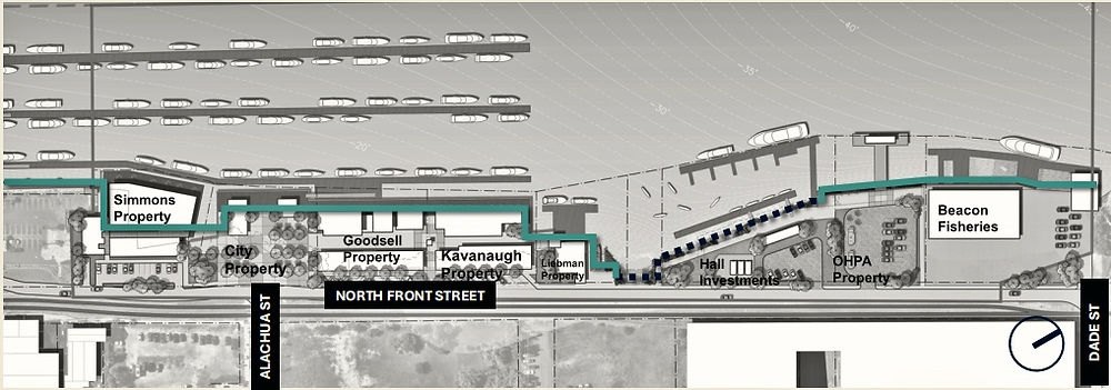
A plan to extend a flood-protection wall along Fernandina Beach's waterfront is heading to the City Commission, but who pays for sections crossing private land remains an open question.
The Waterfront Advisory Board voted unanimously Sept. 29 to advance the draft Harbor Master Plan, first reported by the Fernandina Observer. The plan envisions a wall extending north from the city marina, in places running offshore with fill behind it.
Funding and private land concerns
Resident Eric Bartelt pressed the cost issue at the meeting, questioning who would pay if a flood wall creates new usable land beside private properties along North Front Street. "As a taxpayer, I would be absolutely opposed to that," he said.
City project manager Jacob Platt acknowledged the concern, noting that an offshore wall with backfill faces substantial permitting, mitigation and cost challenges. Platt said the route shown in the draft could change as engineers study options, and dividing costs between the city and private owners will require public discussion in the next phase.
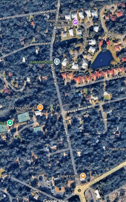
The 45-page Phase 1 study, prepared by consultant Moffatt & Nichol, covers nine waterfront parcels along North Front Street north of the marina toward the port. The city owns one parcel at 101 N. Front St., the Ocean Highway and Port Authority owns another, and the remaining parcels are privately held. The city budgeted $50,000 for the study.
Standards and public access
Ron Flick, an agent for the Simmons development known as Amelia Wharf immediately north of the marina, told the board the property owner intends to self-fund a section of flood wall as part of the project. That section would connect to the city's planned flood protection and leave a stub for a future wall farther north. Flick urged the city to set a common construction standard so other waterfront owners could build connecting sections as they develop. The city currently has no seawall ordinance.
Board member Greg Roland asked what happens if some owners build their sections and others refuse. Platt said the city could explore an ordinance covering construction standards and maintenance requirements, an idea board members supported examining without taking a separate vote.
Board chair Jenny Schaffer emphasized the need for a continuous public promenade along the river rather than a patchwork of disconnected paths. She suggested that if the city pays for a flood wall on private land, it should seek waterfront access rights in return. Platt noted that a promenade easement through the Simmons property has not been settled.
Next steps for the Commission
The draft presents two preliminary concepts: Concept A extends marina docks farther north and places a public fishing facility on the port authority parcel, while Concept B puts a fishing pier at the city's Alachua Street parcel with a different dock layout. The board advanced the draft without choosing either concept.
Platt plans to present the draft at an Oct. 20 City Commission workshop, when commissioners will sit as the community redevelopment agency board. He will seek support for Phase 2, which would expand public outreach, examine engineering and funding, and extend the study south of Centre Street.
.jpg)